


Quote
"Adventure doesn't come with Wi'Fi, but I promise you'll find a better connection."
Updated: January 30, 2019

Disclaimer: If this hike is not a part of the Na Ala Hele "State Maintained" Trails, it may be illegal or dangerous to hike, so do not attempt or HIKE AT YOUR OWN RISK. Hik3beasthawaii is not responsible for any injuries, fines, violations you may incur. This website is solely to showcase the beauty that nature has to offer on the island of Hawaii. *****
Location: An all-in-one hike located deep in Palolo Valley with stream crossings, waterfalls, ridges, and a lookout point at the summit.
Type: Waterfall/Ridge hike
Hike Difficulty: Intermediate
Total Time: 5 hours round trip
Distance: 4.5 miles
Elevation: ~1500 feet
Things to Consider
- Kid friendly: no
- Pet Friendly: no
- Be sure to check out the MuRyangSa Buddhist Temple as well. Free entry and just be respectful of people praying there or if there are any ceremonies going on. Some pictures of the temple are down at the bottom of the page.
- Be prepared for a long journey to get to one of the best views on the island! One of my favorite hikes!
- Sometimes the trail can get muddy, especially after a heavy rain so be careful on the narrow spots.
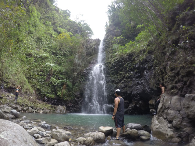
- Bring extra clothes because you will most likely get wet, at least ankle deep crossing the third falls. The first falls has a nice pool to jump in as well.
- There are a lot of erosion on this hike so be careful of footing.
- There are about 4 or 5 stream crossings and 3 waterfalls until you journey up to the rim of the crater.
- This hike goes through a neighborhood so please be courteous of the neighbors and don't litter.
Your hiking backpack
- Bug spray
- 2 to 3 Liters of water
- Snacks/lunch
- GoPro/camera
- Extra clothes
- Life straw if needed.
- Flash light (highly recommended)
Directions
Search for Waiomao Rd in Palolo Valley. Follow the road all the way until the end. The road gets narrow, but there is parking at the end by the housing. Do not park by the church or your car might get towed. There is even the MuRyangSa Buddhist Temple that you can check out before the hike.
Our Journey
Do not try to attempt this hike if it is already past 12pm! It will take around 5 hours and you won't make it back before dark. The forest is incredibly confusing and gets dark really fast. The first time I attempted this hike, we ended up heading back down around 630pm and light was fading fast. We got lost crossing the stream and ended up near some housing. Luckily a resident told us where to go and we finally got back to our car. We were lost for a good two hours. Our phone was also the only source of light and it was dying. I really thought we would be staying the night there. So I highly recommend you bring a flash light just in case of emergencies. You head down past the mailboxes and follow the stream once you reach it. Heading upstream, you cross it about 4 or 5 times. Then you follow the pipe and head up out of the forest into the open and more eroded area of the hike. Then you encounter 3 waterfalls, and the third falls will need to be climbed. Then you head right onto the ridge. You finally get a view of Ka'au Crater which is beautiful! After some uphill climbs around the rim of the crater, you end up at the lookout point on the summit. I love this hike because you get a taste of everything that hiking has to offer in Hawaii. There are stream crossings, rock hopping, ridges, waterfalls, swimming holes, rope climbing, and a lookout at the summit. Definitely one of my favorite hikes!
Also check out the MuRyangSa Buddhist Temple before the hike. Lots of beautiful scenery. Please be respectful of the other people at the temple. Pictures of the temple are down below.
Behind these mailboxes is the start of the trail.

Heading down through the brush to Waiomao Stream.

Following the pipe is sometimes a good idea, but sometimes not. Just look for ribbons if you are unsure where to go.

After about 4 or 5 stream crossings, we followed the pipe up.

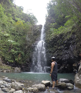
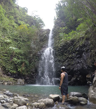
After about an hour to an hour and a half, you will reach the first falls!

Taking some pictures behind the first falls.

Found a nice spot for a hammock too!

The second falls was not too far from the first. About ten minutes apart.

Tried to use the life straw, but it didn't seem to work too well with volcanic water. Lol

Time to head up to the top.

Above the second falls.

There is a lot of erosion heading to the third falls so be careful of your footing.

Lots of ropes to help you get up the third waterfall.

Looking down the falls, the way we came.

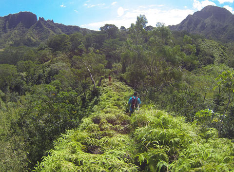
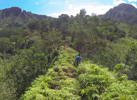
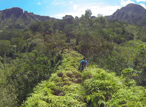
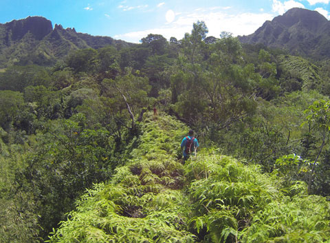
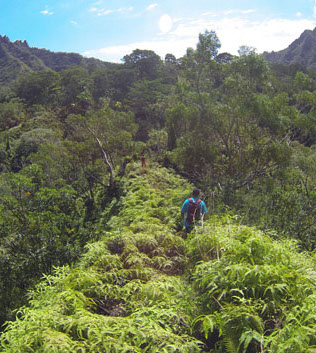
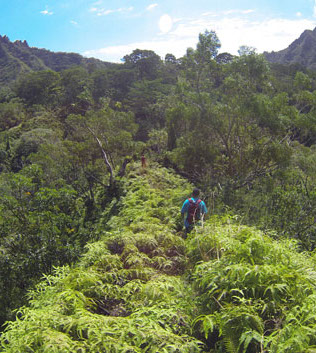
Heading up the ridge looking back towards the crater.

Look at how far we came!

And made it! This is the first views you see looking out towards the left.

Thankfully the view wasn't covered by clouds!

Fun times heading back down the third waterfall.

And now here's some pictures of the MuRyangSa Buddhist Temple.


Add a comment about this post! Was it helpful? Love the hike? Comment below.


.jpg?crc=4281722583)
-crop-u638416.jpg?crc=182749451)
-crop-u6384162.jpg?crc=182749451)
-crop-u6384163.jpg?crc=182749451)